Sunday, July 31, 2011

Mt. Carrigain

Distance: 10 miles   Time: 5:15   Elevation Gain: 3250ft

The heat spell felt by most of the country reached even Northern New England but now order has been restored and it's another perfect, sunny, temperate weekend in the White Mountains. Unfortunately a pulled hamstring earlier in the week threatened my hiking plans, but I wasn't going to let another week go by without some time on the trails.

How I felt about being back on the trail


The first half of the trail was fairly flat or low grade hills, and then it began to climb steadily at a moderate to steep grade for the remaining 2.5 miles.  The trail is entirely forested save for a few hundred feet on Signal Ridge, but much of it is near the top of the treeline so it's still quite bright, and made for a beautiful, relaxing hike.

Looking up at the fire tower on Mt. Carrigain from Signal Ridge

About a half mile from the top the trail emerges from the trees at Signal Ridge, providing a stunning view of Mt. Washington and other surrounding mountains. The trail then ducks back into the trees for another half mile to Mt. Carrigain, on which the summit has a limited view but a fire tower on top provides one of the best views in the White Mountains.

From Mt. Carrigain (4700ft)
View of Mt. Washington, the highest peak in the Northeast

Looking down at Signal Ridge from Mt. Carrigain

Tuesday, July 12, 2011

Squam Lake Bike Ride

Distance: ~40 miles   Time: 4 hours

New Hampshire has it all: the tallest and most rugged mountains in the Northeast, a beautiful lakes region and the seacoast. I'm here for the mountains but I love the water as well and miss the subtle nature of a lake. Florida lakes are sparse, brown and populated with gators; naturally the attraction there is the long, long coastline. 


Just South of Campton lies the four lakes that compose the mid-state Lakes Region. I don't swim, boat, paddle or otherwise participate in water activities but I have been anxious to ride a bike since I left Florida. Paved and dirt bike paths pervade the network of area mountain trails but I enjoy road biking, and the State of New Hampshire was kind enough to draft a series of bicycle routes throughout the Lakes Region.


Squam Lake is the closest, and a ride around it can be had for about 40 miles. I was tired and my legs were heavy from 7.5 hours of hiking the previous day but the ride was considered fairly easy for the area so I went ahead anyway.


As you might expect so close to the mountains, hills abounded and my quads fought every one. I knew I would be dead when I stopped but it was a beautiful ride and I enjoyed every torturous turn of the pedal.

Carter Dome, Mt. Hight and South Carter

Miles: 11.8   Time: 7.5 hours   Elev. Gain: 4100 ft (?)
View all photos

A trio of 4000+ footers and this hike was still anticlimactic after last week's hike up Mt. Washington. It began on the Nineteen Mile Brook trail, aptly named because the first 3.8 miles on it felt like 19. Very gradual climbing, and very dull. Although during the first mile I still managed to wipe out on a slippery rock in front of a family of four. It didn't hurt much at the time but would later be difficult to sleep on.

Junction of Nineteen Mile Brook and Carter-Moriah Trails
Finally I arrived at the Carter-Moriah Trail, which climbs over the first two peaks. And it did climb. The first quarter mile or so was straight up scrambling on all fours, and then it continued climbing at a slightly lesser grade that permitted erect walking.

Looking down from the first outlook after much scrambling (rest!)
View from Carter Dome (4832 ft)
The name 'Carter Dome' provoked visions of a massive rock with elaborate views, yet in reality the rock and its narrow views were relatively unimpressive. Back on down the trail for a while to Mt. Hight. Unlike Carter Dome, which has some tree cover, Mt. Hight rises just above the tree line and is a completely rocky summit.

A fairly clear view from Mt. Hight
By the time I reached Carter Dome the wind had picked up significantly but now on Mt. Hight, with no barriers, it was blowing me with it at 25-30 mph speeds, similar to the winds on the Franconia Ridge hike. This was not a ridge though so the wind could knock me over and I would just fall on a pile rocks instead of off the mountain.

Ever feel like your head is in the clouds?

Below 4000 feet it was a beautiful day in New Hampshire, but above the clouds loomed creating a very cool visual effect. Photography was difficult though since I could barely stand up. The trail goes up and over Mt. Hight, and connects back with the previous trail but it was headed directly into the wind and I had a hard time moving forward so I just went back the way I came.

View from South Carter (4430ft)

From there the trail descends and the long trip back begins. At the junction of the Carter-Moriah and Carter Dome trails is a spur trail that leads to South Carter Mountain, which I took with some apprehension due to my waning excitement. Some nice climbing, but my heart wasn't in it.

Shall we return to the sunny foothills?
By the time I returned to the Nineteen Mile Brook trail, I was so utterly bored and I still had two miles left. The trail here is fairly clear so to break up the boredom I decided to start running in short bursts, walking through the rocky spots to avoid injury. I surely looked like a fool, but it was quite fun.

Artist's Bluff & Bald Mountain

View all photos

This was a short Friday evening hike, about 1.5 miles.

Looking West from Bald Mountain
View of Echo Lake from Artist's Bluff

Saturday, July 2, 2011

Mt. Washington

Miles: 8.4  Time: ~6:00  Elevation Gain: 4300
All photos of Mt. Washington

What better way to spend Independence Day weekend than on the top of Mt. Washington ... well really there is no better way to spend any day. This hike tops Franconia Ridge as my favorite hike, though I think I may have peaked early in New Hampshire (pun intended). Mt. Washington is the tallest peak in the Northeast at an elevation of 6288ft, about 400 ft lower than Mt. Mitchell, the highest peak East of the Mississippi. Though the hike up Mt. Washington climbs 700ft higher in fewer miles than Mt. Mitchell, making it a much more difficult trail. 

From Mt. Washington, 6288ft
There are many routes up Mt. Washington and I chose Tuckerman's Ravine, simply because it's the most popular so why the hell not. The trail head lies at the Pinkham Notch Visitor's Center near Gorham, about an hour and a half from Campton. It's not actually that far, but you have to drive up and around the mountains to get there.  Driving there was blast -- being so close to Canada (about 2 hours), many of the radio stations are French with eclectic musical tastes. On a single station, in succession I heard Paula Abdul, Marshall Tucker Band and a song from the 50's or 60's that I heard growing up but couldn't identify.

More from the top


I didn't arrive until 8:00 because of the long drive and the huge parking lot was already full. I knew it would be packed this weekend, but when climbing tall mountains you have to take the good weather when you get it, and today it was generous. The hiking traffic was not a problem, as the first half of the trail was wide and by the second half I had left the others behind. The initial two miles was over a rocky trail that climbed steadily at a moderate grade, enough to make you breathe hard but gentle enough to plough up at a good pace.

Tuckerman's Ravine
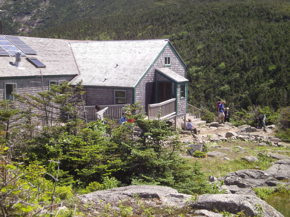
Half-way up the trail is a shelter with restrooms, picnic tables, first aid -- quite the accommodations. After this is where the real climbing begins. The trail emerges from the trees and offers a spectacular view of the ravine that you just climbed up next to. The rocky trail turns into rocks, and eventually steep, steep rocks, alongside a sheet of resistant snow and ice. I thought it was granite (this IS the granite state after all). The icing on the trail (yes another pun) was a nice little stream flowing downward over it, slicking up the rocks.


Come on now, that is granite (ice??)


Honestly, I was really scared climbing up this portion of the trail. It was very steep and very rocky and I am very off-balance (in more ways than one...). Falling meant literally falling down thousands of feet into the ravine below. Finally, the grade lessened just enough to provide a level of comfort, and just then a couple of hikers appeared behind, and then passed me like they were walking up the escalator at a mall.

This doesn't look so bad in pictures!


A half mile from the top is a junction of trails; a meeting of hikers for a final push to the top. Here is where I talked to the first hiker who told me the granite was ice. Life is a series of circles, and I find I am half-way around one now. When you are a child you believe everything you are told. When you become a teenager, you believe nothing you are told, and you know all. This continues into your twenties, when with any luck, a boss or teacher or parent or close friends slaps you across the head and reminds you that you are an ignorant fool and you should listen to your elders, and open your mind to the thoughts and beliefs of others, regardless of their race, religion or education. At some point you achieve some moderate success in your career, or are otherwise happy in your life choices, and you start to feel again like you must know all to have reached such a point of clarity and peace.

That's the top!

So, I thought the guy was an idiot. Even though he talked up the trails like he was born on one, I had read somewhere about the white granite in the rocks of the White Mountains, and in fact had seen the granite-covered rocks first hand. And it wasn't cold! Who was the fool now?

I'm there but they're not!

Well, me of course, for many reasons, but let's start with one.  This particular guy was with a group of other hikers who had come up a different trail (one I must do!) and they were milling around the junction, the men politely urging on the ladies to go first, even though we all knew they would pass them very soon and it was a moot point. Annoyed at the indecision, I went ahead of them and of course this man quickly passed me.

Who's the idiot now?

When climbing up a mountain of rocks, the trail is more of a suggestion. We can all see the top, and it doesn't matter which rocks you climb to get there. But of course the trail crew (in this case the Appalachian Mountain Club) marks a suggested trail to the top, one that is likely easier than others. To avoid congestion, the experienced hiker will climb an alternate route, one that might be easy for him but difficult for others. A less experienced hiker like myself might follow whoever is in front of her since she can't take her eyes off the rocks lest she fall backwards into a ravine. So I followed this person into a bunch of rocks that I had to navigate back from in order to avoid further danger (uggh!!).

I think I read the same sign on Mt. Mitchell in NC

Eventually I reached the top, a mass of tourists who arrived by car and trolley. The only thing I could think about was how scary the trip down would be, and several hikers (including the snow/ice guy) suggested the Lion's Head trail as an alternate to the bottom. I had read that this trail was steeper than Tuckerman's Ravine, and as such I concluded it would not be a safer trip down, but I chose to listen and I'm glad I did.

The REAL summit -- no I did not grow chest hair

 The trip down was actually a lot of fun, and not as scary or difficult as I thought it would be. Lion's Head was definitely a lot easier (at least on the return), and I met some very cool people along way. Half-way down I met up with a very interesting woman from Boston and we chatted all the way to the bottom.

The more sensible route down


It's not a bad day when you can hike the best trails, meet some great people, and then enjoy a beer in sunny, 80 degree weather in July. Though I wish my family and friends were here to enjoy it too.


On the return, maybe a mile or less from the top

Sunday, June 19, 2011

Franconia Ridge

Distance: 8 miles  Time: 5:50  Elevation Gain: 3800ft
All photos


The Franconia Ridge Trail traverses the ridgeline of three 4000ft peaks, all above the treeline, providing some of the best views in New England. Personally, it is the most spectacular, challenging hike I've done yet.

Franconia Ridge Trail
The classic ridgeline loop hike starts at the Lafayette Campground in the Franconia State Park just North of Lincoln. The Old Bridle Path climbs three miles to the Greenleaf Trail, which takes you to the top of Mt. Lafayette. From there you take the Franconia Ridge Trail over Mt. Lincoln and then to Little Haystack Mountain. You then take the Falling Waters Trail back down to the campground.

Admiring the view from Mt. Lincoln (I think)
At the trail head were two women who were doing the above loop in reverse and suggested I do the same if I wished to avoid the steep rocky descents on the Falling Waters Trail. I was easily convinced, so I followed behind them.
Waterfall along the Falling Waters Trail

The Falling Waters Trail is a maze of broad, steep rocks and stream crossings, following the ascent of a waterfall, shifting one side to the other with the trail designer's whim. The footing is tricky but manageable until I meet a possible spawn of yesterday's barrier rock and must climb or retreat (okay, it was a neonate, but still...). I had dropped the women hikers a while ago and the other groups I had passed were far back enough not to witness my embarrassing attempts over the rock.

Looking down on the evil rock

 To the right of the rock was a dead tree, which when tugged hard, nearly came down, but it was the only source of traction I could find. So I used it to get half way up the rock, hoping it wouldn't give out under my feet, but I was still a few inches from another tree that I would need to grab to get up the rest of the way. I jumped a little to reach it, missed, and slid back down the rock, bloodying my knee and scraping away skin. I tried again and got it, using all the strength in my feeble biceps to pull myself up the rest of the way.

Trail crosses the waterfall
After a couple more stream crossings (one a full-fledged waterfall crossing), the waters fell back and the trail began to climb in earnest. It was still extremely rocky and required using hands some of the time, but my feet were dry. I was having a blast.

I see light! Approaching the end of the Falling Waters Trail
But all good things must come to an end, and sometimes something even better succeeds it. In this case, about 5000 feet better.  I knew I was nearing the end of the Falling Waters Trail and approaching the first summit because I saw light coming from above, but the trail kept climbing and climbing.

Almost to the first summit!

When I was able to finally stick my ahead out of the trees, what I saw and felt was a shock. After hours in the forest with little clue about what existed around me I was presented with the pile of steep rocks that is Little Haystack Mountain, and 25-30 mile per hour sustained winds.

Someone emerging from the Falling Waters Trail
 
From Little Haystack Mountain, 4800 ft.
From there it was just a short climb to the top at 4800ft, but I was so giddy it make the trek difficult. Also the wind gusts required that I stay close to the ground lest I get knocked right off. 


When I finally made it, I found several groups of people nestled in the nooks on the other side trying to escape the wind. I just wanted to stand on top and absorb it. Immediately my hands were freezing. With the wind chill it was about 45 degrees but it felt much colder. Strangely nothing else felt cold, even though I was wearing shorts.

Climbing one of the other peaks
Next was Mt. Lincoln at 5089ft, then Mt. Lafayette at 5259ft. Climbing up and down these peaks along the ridgeline was completely ridiculous. Stunning, amazing, but crazy. The wind gusts had to top 40-50mph, and catching one at the wrong time could send you plunging off into the valley. Holy crap was it great though!

Top of Mt. Lafayette (5259ft)

Climbing down Mt. Lafayette was not as great. It was pretty scary at times near the top where the wind was still gusting heartily and I was trying to not fall down the long cascade of rocks that sweeps you to the bottom.

I could really use a sled here

At the bottom of Mt. Lafayette, before starting the final descent is an AMC hut -- I finally get to see one! This one is immaculate with clean bathrooms, free coffee, a full kitchen and rooms of bunk-cots for overnighters.

AMC Hut

The top stretch of the Old Bridle Trail is just as rocky and difficult as the previous trails and my feet are killing me. It's definitely not an improvement over the Falling Waters Trail as I had been instructed. After about a mile; however, the trail smooths out a bit and by the last mile it's nothing more than a nice stroll through the woods. Thank you Sue.

I was just up there! Looking up at the Franconia Ridge Trail from Old Bridle Path

Saturday, June 18, 2011

Welch-Dickey Loop

More photos of Welch-Dickey Loop

It started raining mid-afternoon on Friday, continued through the night, and was forecast to clear up Saturday afternoon. When I woke it was overcast but not raining. Unsure what to expect with the fickle weather here, I decided to take a drive instead of risking a storm on a mountain ledge somewhere.

Scenic overlook on Kancamagus Highway, around 2400 ft.
Conway is a little over an hour Northeast of Campton and is the choice destination for White Mountain tourists. I had originally planned to stay there but couldn't find a campground for under $900 per month -- pretty steep for a patch of grass and 30amps. I'm glad it didn't work out.

It's Laconia Bike Week -- They are everywhere!

Because there's a few mountain ranges between the two towns, the most direct route is the Kancamagus Highway, a 34-mile scenic byway through the White Mountains, not unlike the Blue Ridge Parkway. Shortly after I left the sky cleared and it was a beautiful, sunny drive up through the mountains.

The rocky summit of Welch Mountain
The congestion in Conway immediately aggravated me so I turned around and headed home so I could retrieve my hiking gear and find a trail. Right around the corner from the campground is the Welch-Dickey Loop, a four-mile round trip that cross that crosses two rocky summits.

View from Welch Mountain (2605 ft)


The trail begins in the forest and climbs gently first to the rocky ledge of Welch Mountain, which provides stunning views of Waterville Valley and the surrounding mountains. Here the trail continues up and around the rocky face of the mountain, which was fun to climb, initially. Then I reached a point that climbed very steeply up the rock face, unnavigable to me (and I imagine a few others).

Much scarier going back down!
At the base of the rock was a trail marker so I knew I was at the right place, but did they really expect people to scale this rock? Yes, the trail did in fact ascend the crag and continue down the other side, but instead I returned to the trail head the way I came, defeated by yet another personal impasse.

The crag that bagged me